
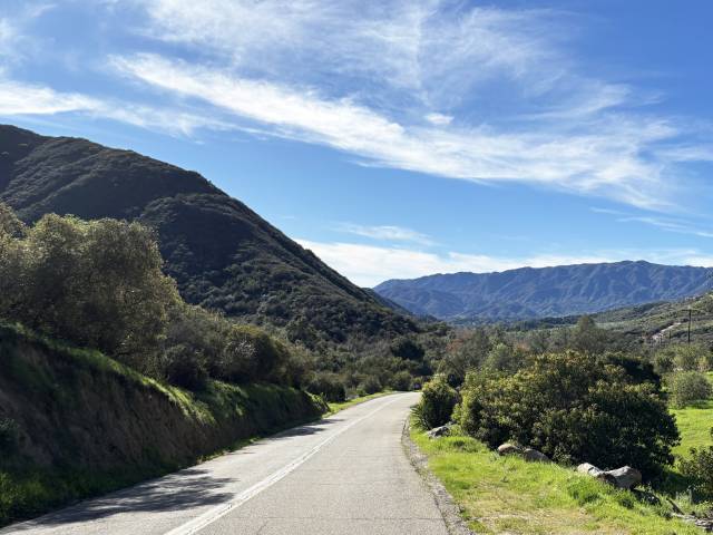
Tucked into the south end of the Santa Ana Mountain range, that are bisected by San Diego and Riverside Counties, and bordering Camp Pendleton is a network of roads that access nurseries, vineyards, ranches, residences and the Cleveland National Forest. Due to the rugged topography there’s barely a straight and level road in the entire area, which means it’s a great place to ride a motorcycle. Unless you’re a local, you’ll enter the area via the 15 Freeway either off Clinton Keith Road in Wildomar or Rancho California Road in Temecula and head west, you could also come in via Fallbrook. Look at a map and it seems like you could make a nice looping route of the roads but unfortunately several are private access only or turn into dirt roads. The latter is no issue if you’re riding a dual sport or adventure tourer, but the route described is asphalt only.
Starting in Wildomar, head southwest on Clinton Keith Road as it shrugs off city residences and passes the Santa Rosa Plateau Ecological Preserve. The road is rhythmic with slight kinks and undulations. At about five miles the road curves to the right and changes its name to Tenaja Road, but that moniker doesn’t last long either as just 1.7 miles later it becomes Via Volcano. A short mile later you’ll turn left onto Avocado Mesa Road at a crossroads but then the street schizophrenia continues as you make a sharp 90-degree right and the route turns into Los Gatos Road. At the crossroads with Carancho Road turn left and continue for about two miles until you reach the crossroads with De Luz Road, which then, thankfully, you’ll stay on, without name change, for 16 miles until you reach Fallbrook.
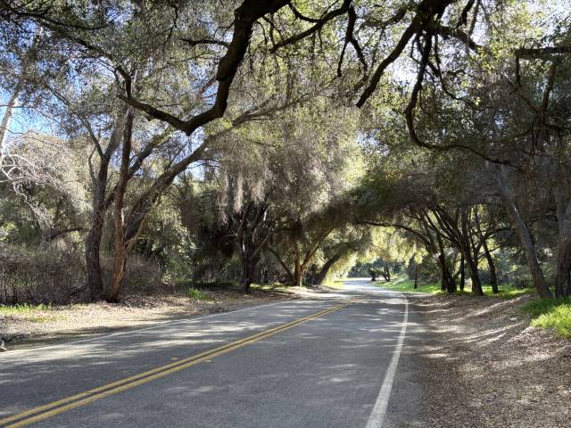
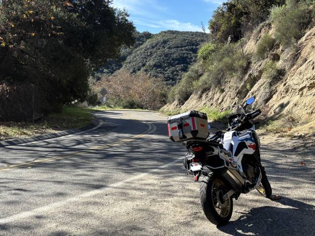
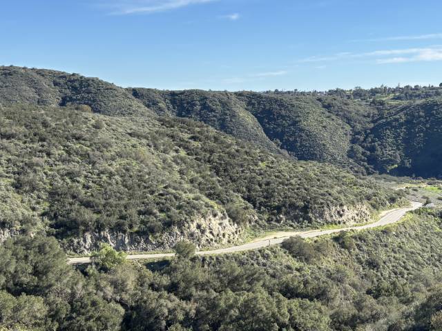
After zigzagging across the Santa Rosa Plateau of boulder-strewn and Live Oak dotted meadows, the route drops down into the canyons starting on Los Gatos Road where you see views of the lower elevations of the Santa Ana Mountains. The route undulates up and down on Carancho Road but then slots into a canyon and heads due south once you turn onto De Luz Road and follows its random squiggles with overhanging tree tunnels and multiple possible water crossings. You’ll not need to worry about any water or slippery slime most of the year but be cautious if there has been recent rain and heed the warnings to not cross if it’s deeper and fast running.
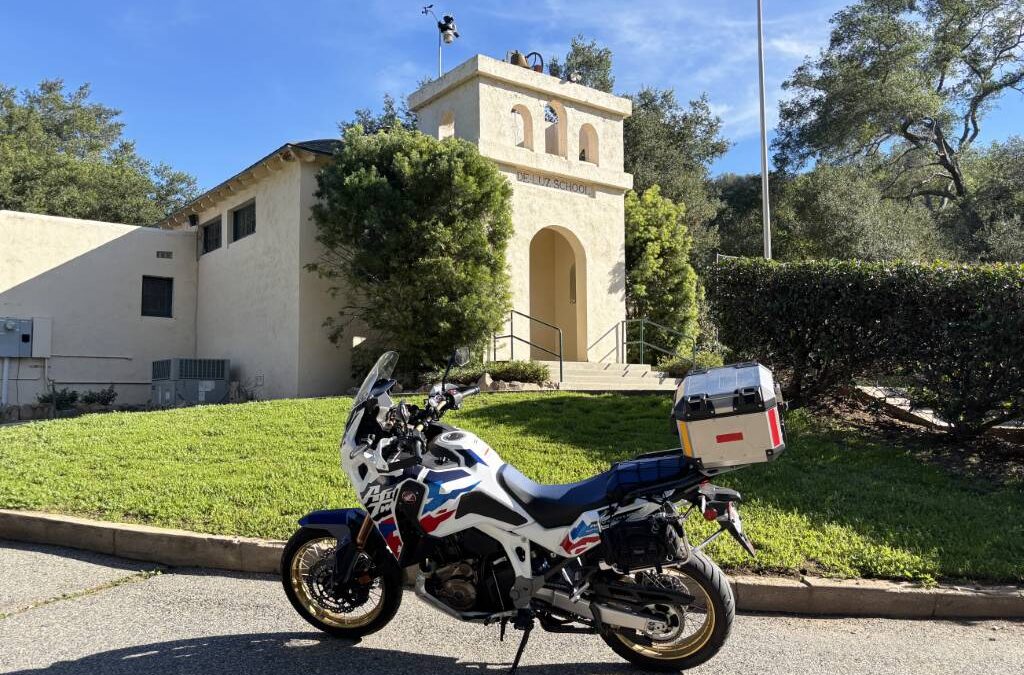
About 17 miles along the route from the 15 Fwy at 40153 De Luz Road you’ll want to stop at the De Luz School and Ecological Center. It’s a great place to stretch your legs, have a snack or lunch on the picnic table, enjoy some shade from the large trees, and to take photos of the beautiful little schoolhouse that was built in 1927. After the schoolhouse the road continues to kink as it drops down rapidly into the Santa Margarita River Canyon until popping up again on the other side and heading south into Fallbrook, where there’s plenty of great places to stop for refreshments on and around the Main Street. Leave Fallbrook by backtracking the same route and enjoy the same roads with switched directions and elevation changes. As you reach the intersection with Carancho Road, stay on De Luz Road, which not long after becomes Rancho California Road. A S-turn of consecutive 180-degree curves drops you down into Temecula as a fun farewell and then follow the road to the 15 Freeway.
See the route at: As an introduction to the area and perhaps explore some of the connected roads. Enjoy!